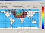
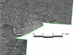
You are here
finished project
SISNeT
4. August 2010Signal in Space through the Internet (SISNeT) is name of technology that disseminates accurate navigation data from EGNOS system through the Internet. A new-generation data server which is the main pillar of the services has been developed, as well as the software called SBAS TeACHER who serves as a tool for SBAS messages editing.
EGNOS Edutools
3. August 2010GSE LAND
17. September 2009GSE Land is a project of Europian satellite monitoring, which is preparing the conditions for the operation of GMES Land Monitoring Core Service. The output map products are based on a combination of satellite imagery and other auxiliary data. The outputs are used for example in agriculture and soil protection or urban planning.